In the history of Tucumcari there is a monumental mystery. Two obelisks? Route 66 historians are well aware of the Ozark Trail obelisk that served as a guidepost for early motorists prior to the establishment of the federal route system. The Ozark Trail was a network of locally maintained dirt roads linking Colorado, Texas, Missouri, Kansas, Oklahoma, New Mexico and others. One branch of the Ozark Trail conncted Amarillo and Tucumcari. When Cyrus Avery defined Route 66, he did so connecting the dots of existing trails and roadways.
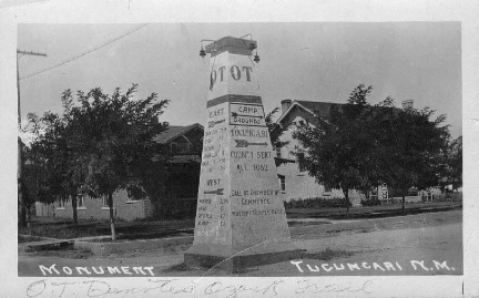
Twenty one Ozark Trails route marker obelisks were arrayed across the network with one of these located in Tucumcari at the intersection of 2nd and Gaynell streets. The postcard photo below shows Tucumcari’s obelisk. The obelisks were made of reinforced concrete by local contractors. Seven of these markers still exist, one of these located in Lake Arthur, New Mexico, which was built in 1921 by a local contractor for $250. Ozark Trail obelisks were specified at 21 ft tall with illuminating lights.
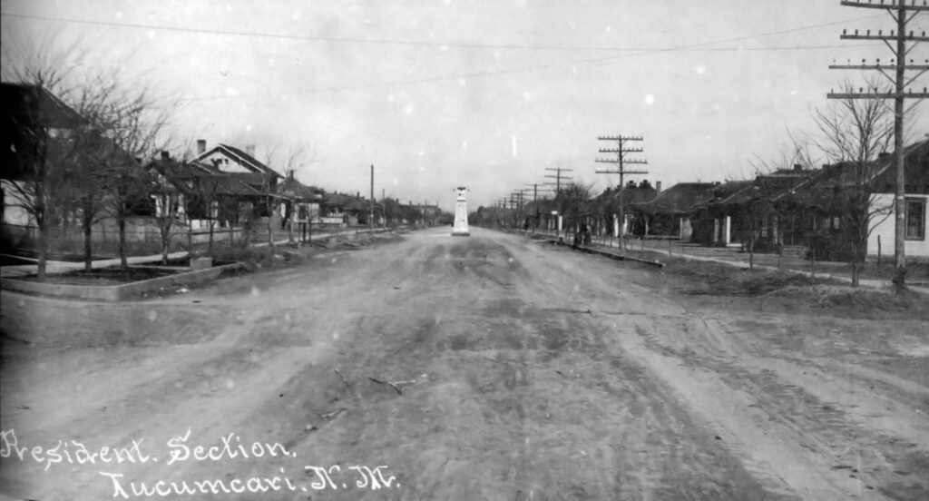
Next image shows a long view with the obelisk far in the background in a residential area.
Below is a different long view of an obelisk not in a residential setting. This view, sighting along 2nd street, is in a commercial setting. If you look closely, the exterior faces of the obelisk have changed and a flagpole is present.
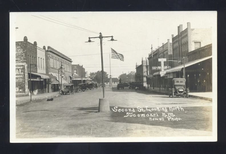
The image below may explain the obelisk mystery. The federal highway system was established in 1926 and uniform route marker signs were installed along the roadway. With these highway shields installed, Ozark Trail route signs were no longer relevant.
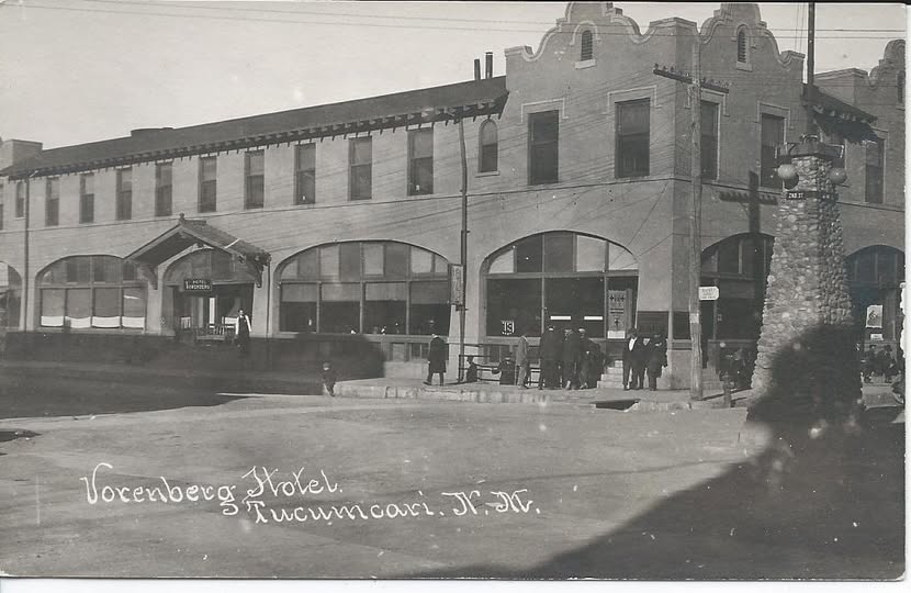
In this view, the obelisk is not in the same location, it is in a commercial area co-located with the Vorenberg Hotel on 2nd Street and Main Street. This is obelisk has the same base, the same pyramid shape, the same lights, the same pyramid cap, and a flagpole. However, the exterior face are covered with stones. Perhaps this was done to cover up the directional info and arrows that were on the original Ozark Trail Marker. It appears that the obsolete Ozark Trail obelisk was repurposed to serve as a landmark.
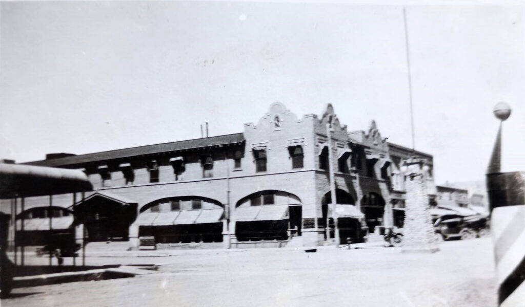
The above view of the obelisk is at a different angle.
If the original Ozark Trail obelisk was located at 2nd and Gaynell as reported in Tucumcari’s newspaper report on the construction of the obelisk and the image of an obelisk across from the Vorenberg shows a location at 2nd street and Main, then as the map below shows, the obelisk took a hike seven blocks north.
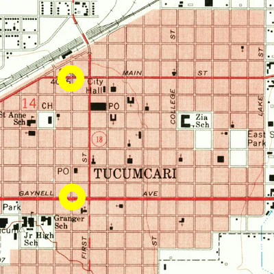
Reviewing a series of historical images of the Vorenberg suggest the obelisk didn’t remain at the Vorenberg location very long, perhaps for the reason it was a traffic hazard. The obelisk was removed and apparently discarded. Some folks would like to see the Ozark Trail marker reconstructed in Tucumcari. Why not?
Images selected from Tucumcari Then and Now Facebook page. Article by Johnnie Meier.
Historical Documents
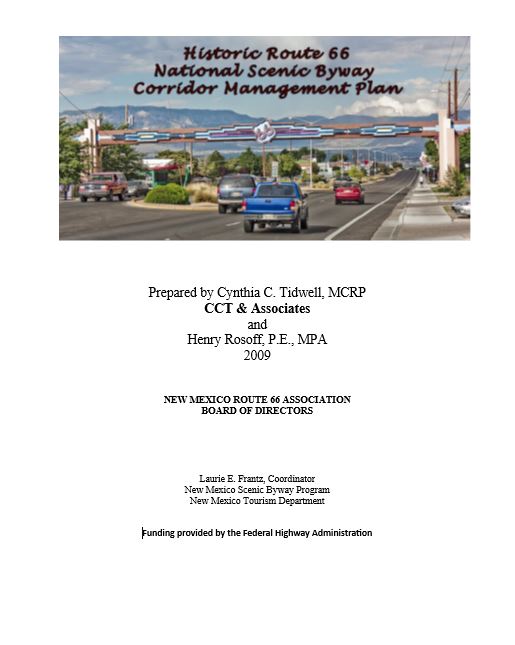
This National Scenic Byway Corridor Management Plan was presented in 2009 by our board member, Cynthia Tidwell. (So proud!)
New Mexico was the first of all the states to earn status as a National Scenic Byway. This document helped offer other states a template to apply for their designation too. Click here to download a copy of the document.
Click here for an article from the National Parks about the history and significance of Route 66.